GIS & Photogrammetry Services
Sk Consulting Engineers - Surveying Engineer NTUA - MSc in Geoinformatics NTUA - Agronomist - Ioannina
At SK Consulting Engineers we combine topography with geoinformatics (GIS), offering modern mapping, analysis and visualization services for geospatial data. Using advanced GIS software and modern photogrammetry techniques, we transform field data into reliable and useful information for the client.
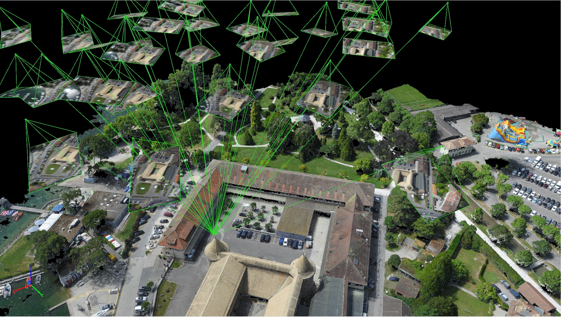
We use drones and high-resolution satellite images to produce orthophotomaps, i.e. georeferenced photographic maps with exceptional clarity. Orthophotomaps combine the accuracy of a topographic diagram with the richness of aerial photography and are a valuable tool for infrastructure studies, urban planning applications, environmental management or investment planning.
From orthophoto maps, we produce Digital Terrain Models (DTM), Digital Surface Models (DSM) and 3D visualizations, offering a realistic basis for spatial planning, elevation estimation, engineering project studies and geomorphological feature evaluation.
At the same time, we implement customized Geographic Information Systems (GIS), organizing and structuring geospatial data such as utility networks, land uses, points of interest or technical infrastructure. We create thematic maps and digital platforms that allow interactive exploration, analysis and decision-making in real time. GIS systems are ideal for municipalities, engineering companies, businesses or private investors.
Finally, we provide photo interpretation services for aerial photographs and satellite data. We analyze historical and contemporary images to document changes in land use, determine the time of construction of buildings (useful for arbitrariness and legalization), check changes in the coastline or terrain morphology.
- Orthophoto Production: Creation of high-resolution color orthophoto maps from drone or satellite images, fully georeferenced and suitable for use in a GIS environment. They offer measurement accuracy in large-scale areas.
- 3D Models & Mapping: Production of DTM/DSM, 3D city models, volume mapping and 3D visualizations for civil protection studies, infrastructure projects and technical presentations.
- Thematic Maps & GIS Applications: Creation of environmental maps, network maps, urban thematic maps and development of fully customized GIS applications for agencies, businesses and technical organizations.
- Photointerpretation & Geospatial Analysis: Technical photointerpretation studies for legal documentation or research purposes: proof of construction time of arbitrary, objections to forest maps, analysis of coastline changes and terrain morphology. The reports are accompanied by maps and diagrams for immediate understanding.
|